UPDATED: The Fraser Valley Regional District (FVRD) issued evacuation orders to five properties at Harrison Bay on Wednesday afternoon and is encouraging communities on the north side of the Fraser River to have a ‘grab ‘n go’ emergency kit ready in the event of evacuation. Communities under advisory include Hemlock Valley, Harrison Mills, Lake Errock and several First Nations including Douglas, Leq’a:mel, Samahquam, Scowlitz, Skatin and Sts’ailes.
The FVRD’s emergency responses are based on water level readings from the flood gauge in Mission, where the latest readings read 5.7 metres. The emergency response plan is activated when the gauge reaches 6.5 metres.
The rest of the Fraser Valley remains in a wait-and-see mode for flood risks, and the Agassiz-Harrison area is no exception.
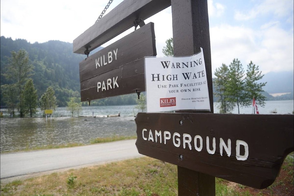
Higher than normal water levels have been recorded around the Fraser and Harrison River, and now seepage is appearing in rural fields outside dyke systems in the District of Kent. Kilby Historic Site is open for the long weekend, but its campsite on the Harrison River is closed due to flooding, and even a small part of the Sandpiper Golf Course has been swallowed up by the river.
Persistent warm temperatures across the province over the last month has led to an early runoff period for the Fraser River and flows are expected to continue rising over the coming long weekend and the week following.
The District of Kent has issued a high stream flow advisory and released notices asking the public to exercise extreme caution around all bodies of water, including recreational areas near rivers, sloughs and streams.
A second freshet update from the District on Wednesday estimated that river levels will peak Monday and are expected to reach levels similar to what was seen in 2012 and 2007.
The District’s update says low and mid-level snow packs have depleted by up to 60 per cent, therefore “weather systems and snow accumulations of the Upper Fraser River will be monitored as key factors in determining next steps.”
District and Village staff continue to monitor water levels daily. For a regular real time updates on hydrometric data, visit the government of Canada’s website.
RELATED: Fraser Valley in wait-and-see mode for flood risk from freshet
RELATED: Agassiz, Harrison water levels rising as expected, for now