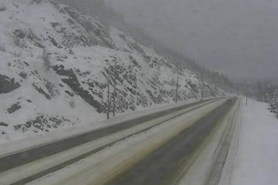
Environment Canada is forecasting between 30 and 50 cm of snow for the Coquihalla Highway from Hope to Merritt and for Highway 3 from Hope to Princeton via Allison Pass, from Monday until Wednesday.
The heaviest snow will fall from Monday night into early Wednesday morning.
Winds will be particularly strong near the summit and the passes through Tuesday. Wind gusts up to 80 km per hour will generate blizzard-like conditions with near zero visibility.
While on the Okanagan Connector from Merritt to Kelowna and the Trans-Canada Highway from Eagle Pass to Rogers Pass, Environment Canada is forecasting amounts to exceed 15 cm of snow.
Light snow is anticipated in these regions on Monday afternoon and will intensify at night, continuing through the day Tuesday. Snow will taper to flurries on Wednesday.
Travel is not recommended on these highway passes unless necessary, according to DriveBC.
Conditions will improve on Wednesday for most of the region.
❄️⛔️SNOWFALL WARNING - Up to 50cm of snow possible for #BCHwy5 #Coquihalla tonight with additional snowfall throughout the day and evening tomorrow. Expect major delays and poor conditions. #HopeBC #Merritt
— DriveBC (@DriveBC) January 8, 2024
READ MORE: Snowfall warning in effect for the Okanagan-Shuswap-Boundary